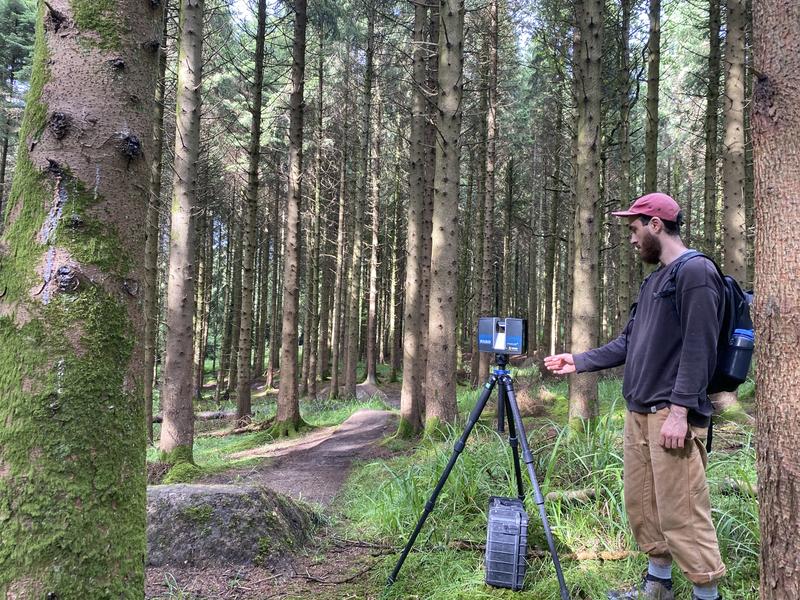
Clients hire me to 3D scan things of all sizes – from household items to buildings, properties, forests and more. I work with a range of toolsets including both LiDAR and photogrammetry.
Beyond data capture, you can bring me in on a project to manipulate and process scan data in all sorts of ways:
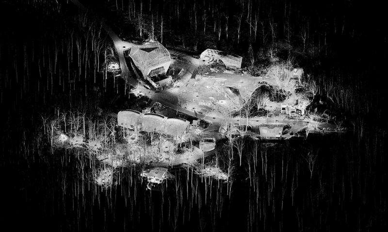
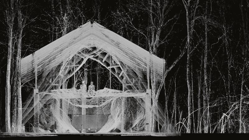
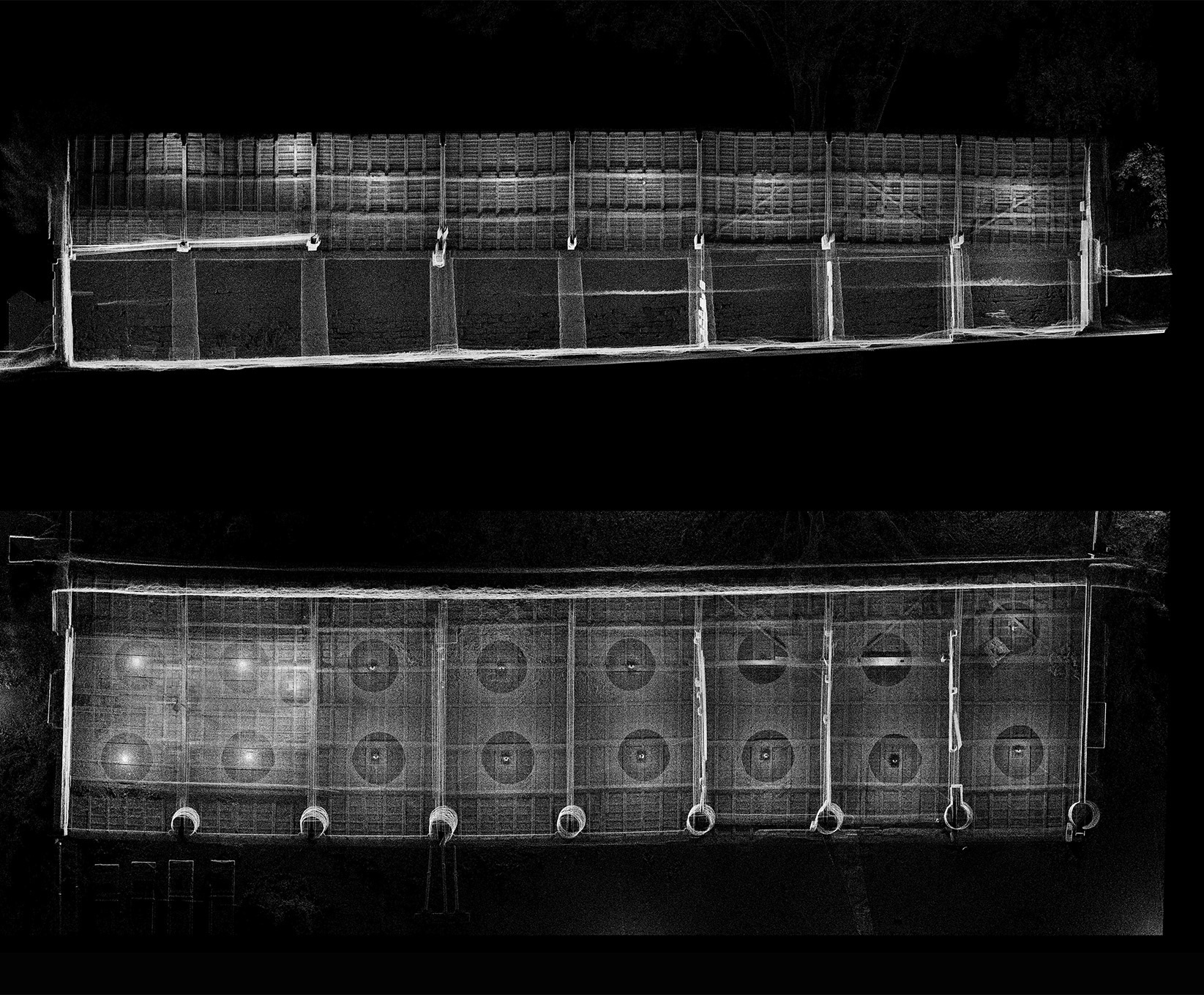
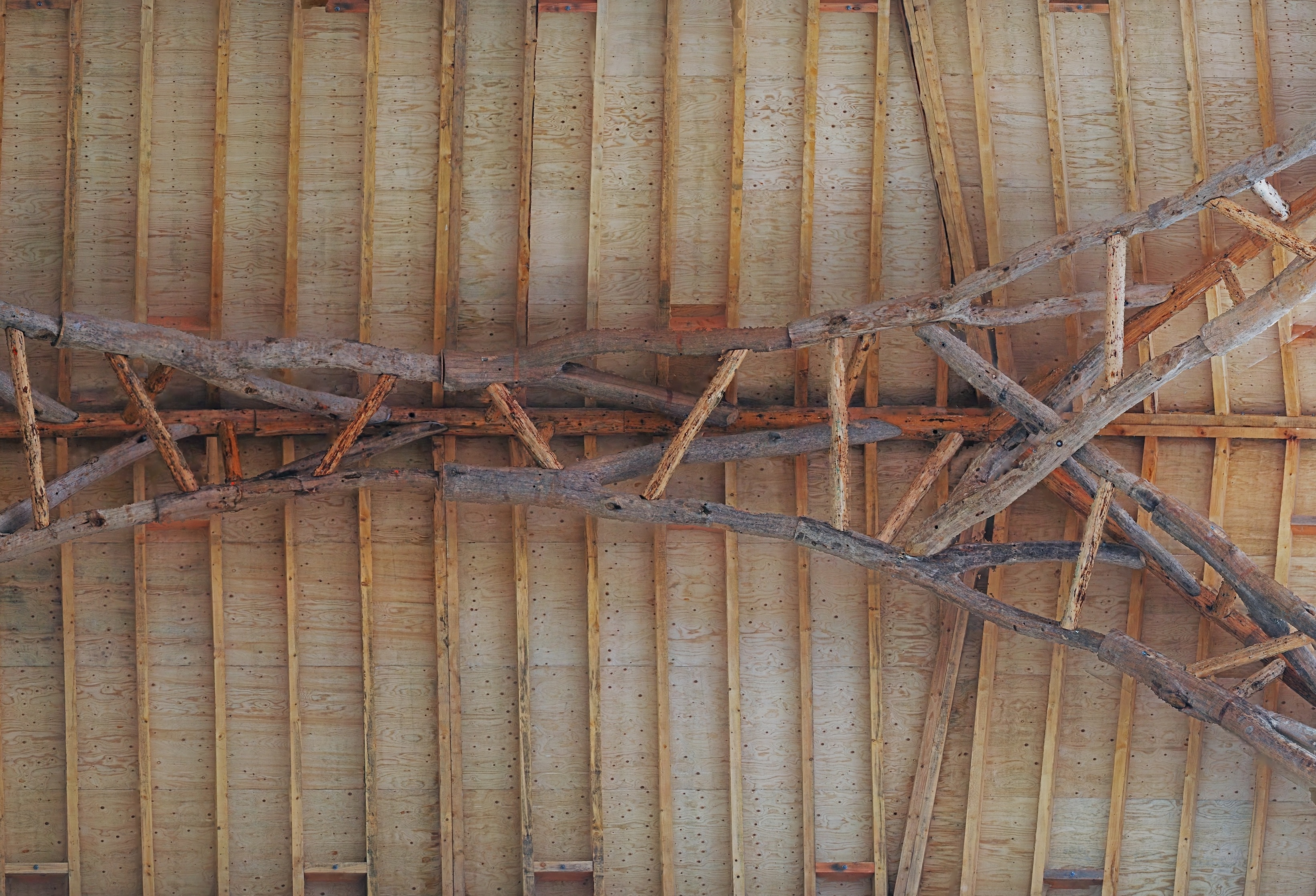
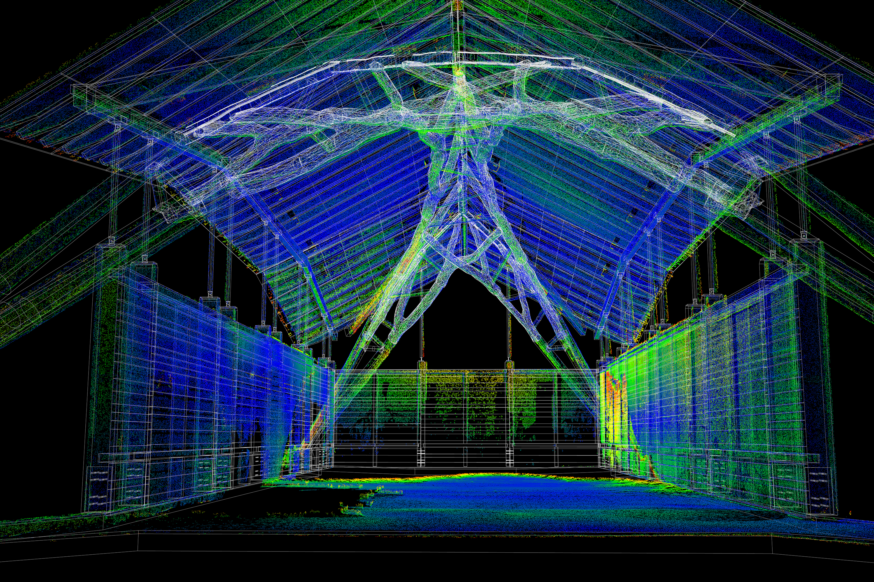
3D LiDAR scanning was used to quantify a barn’s gradual displacement from groundwater, enabling precise measurement of movement and the design of targeted interventions to stabilize and protect the structure. Case Study
I deliver accurate point cloud models for sites across Ontario and Nova Scotia, and can supplement existing data with high-detail scanning where more precision or coverage is required.
Physical models can be scanned to create presentation visuals or rescaled for fabrication, allowing accurate reproduction at new sizes—including full-scale—while preserving the original design’s proportions and details. Work with students in Hooke Park (UK). Case Study
I refine and align client-supplied LiDAR or photogrammetry datasets, resolving issues with incomplete or imperfect captures to produce a coherent and usable model.
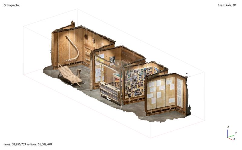
Raw point clouds or meshes are translated into editable surfaces and linework, providing clients with familiar file formats ready for design development or fabrication workflows.
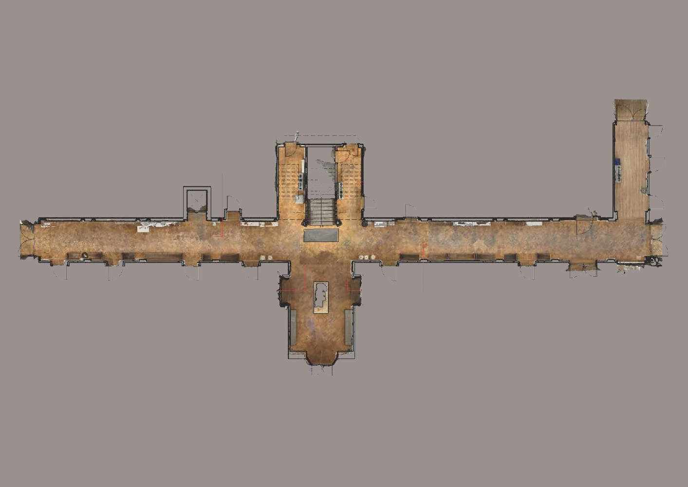
Scan data is transformed into precise, layered drawings that integrate textural detail with conventional linework, producing richer documentation of existing conditions. Image by student Roxanne Bustard. Case Study
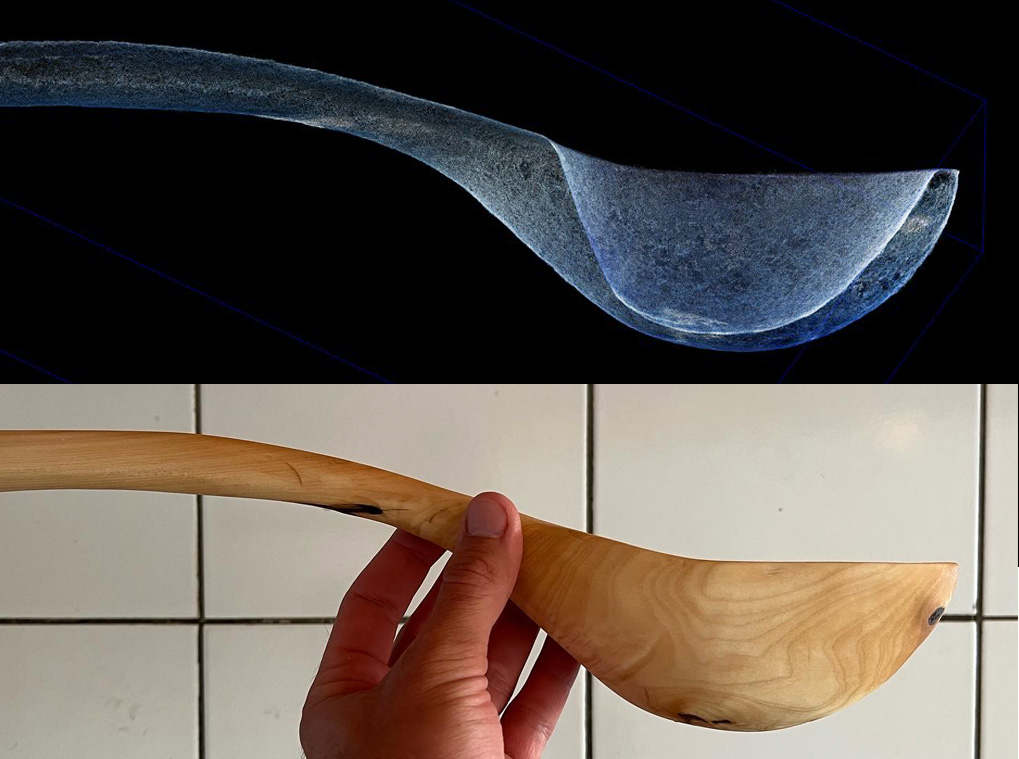
Scan data supports refinement of handmade forms and enables exploration of new fabrication methods, bridging traditional craftsmanship with digital production techniques. Case Study
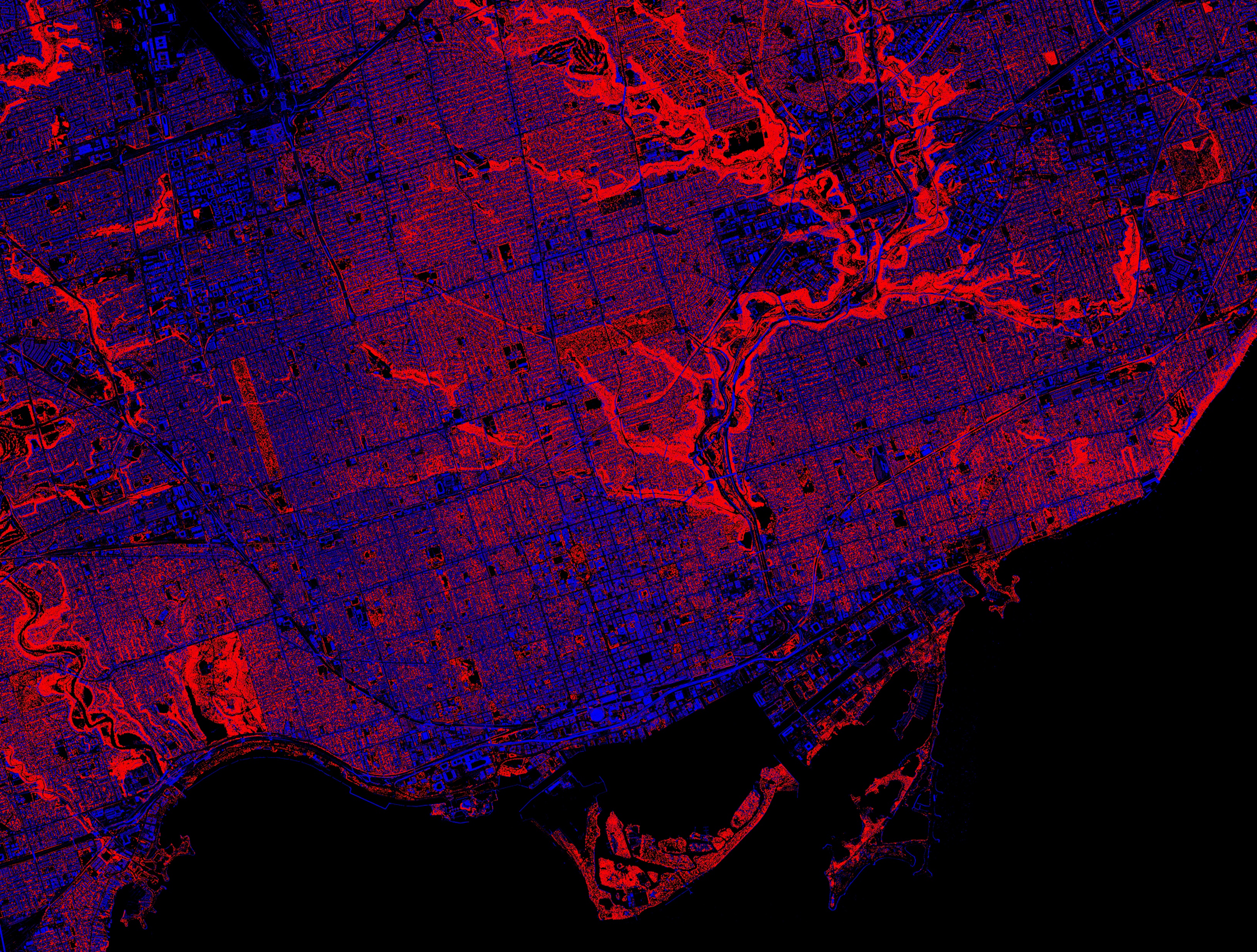
Digital models can be classified into categories such as natural and built features, enabling targeted analysis of canopy cover, shading, and other urban design metrics. Case Study
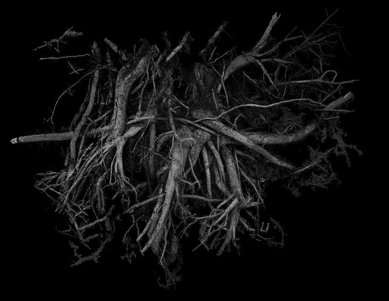
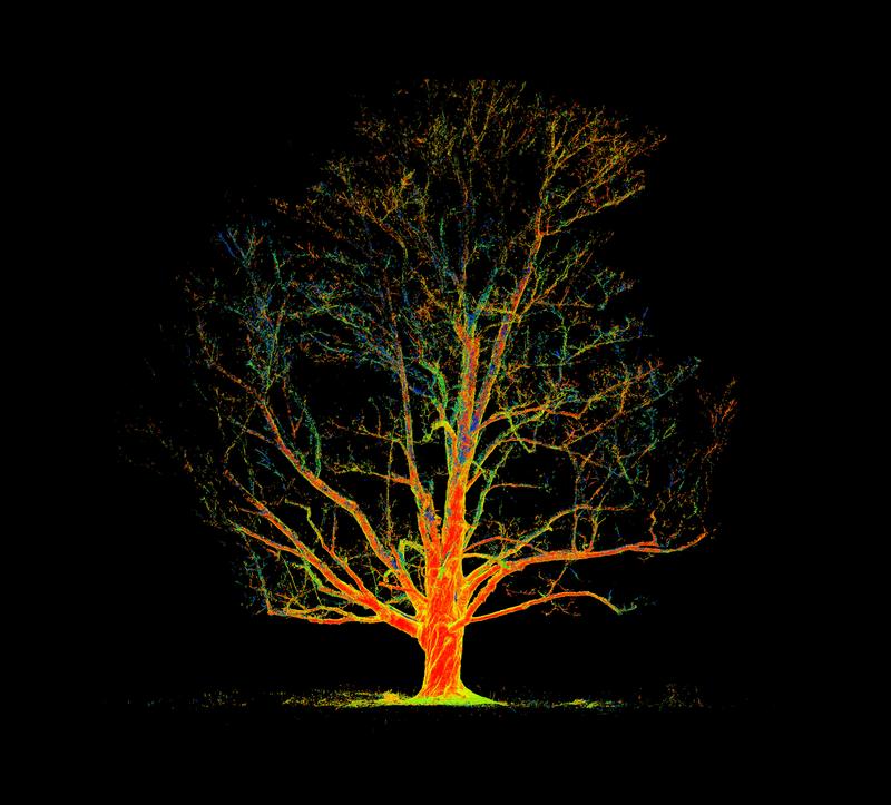
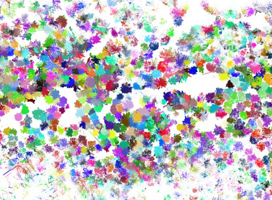
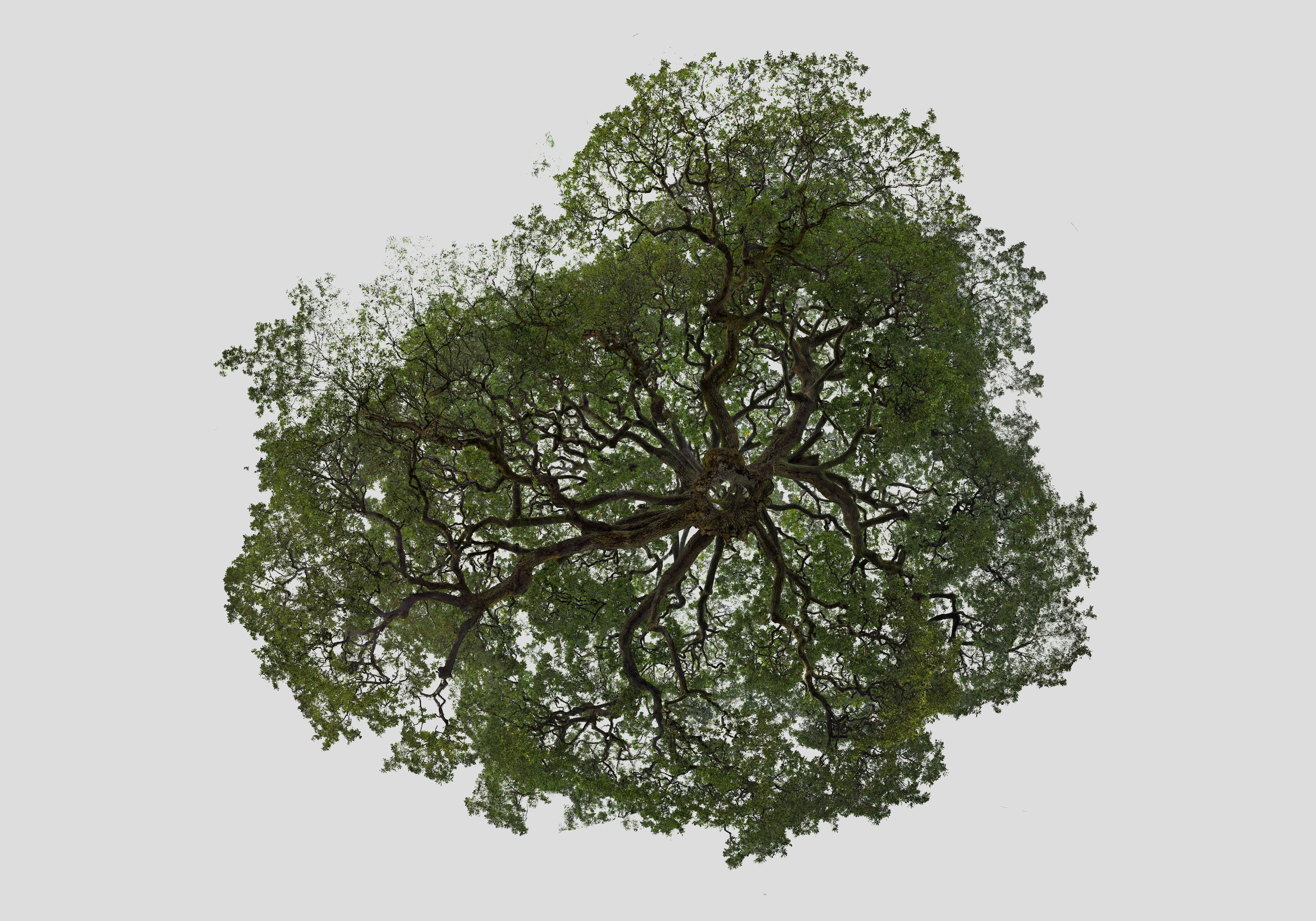
Automated processes can separate hundreds of individual features—such as trees—from complex scans, supporting detailed inventory, mapping, and analysis work.
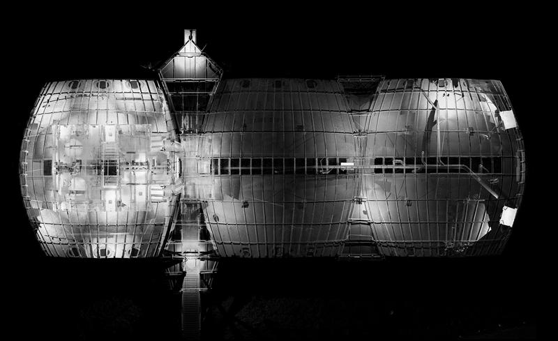
Scan data can be transformed into still renderings or animations in styles ranging from abstract compositions to photorealistic simulations.
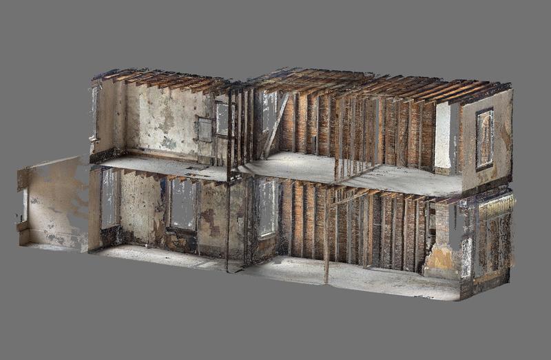
Construction progress can be scanned and measured in 3D, identifying deviations from design intent and informing necessary adjustments before completion. Case Study
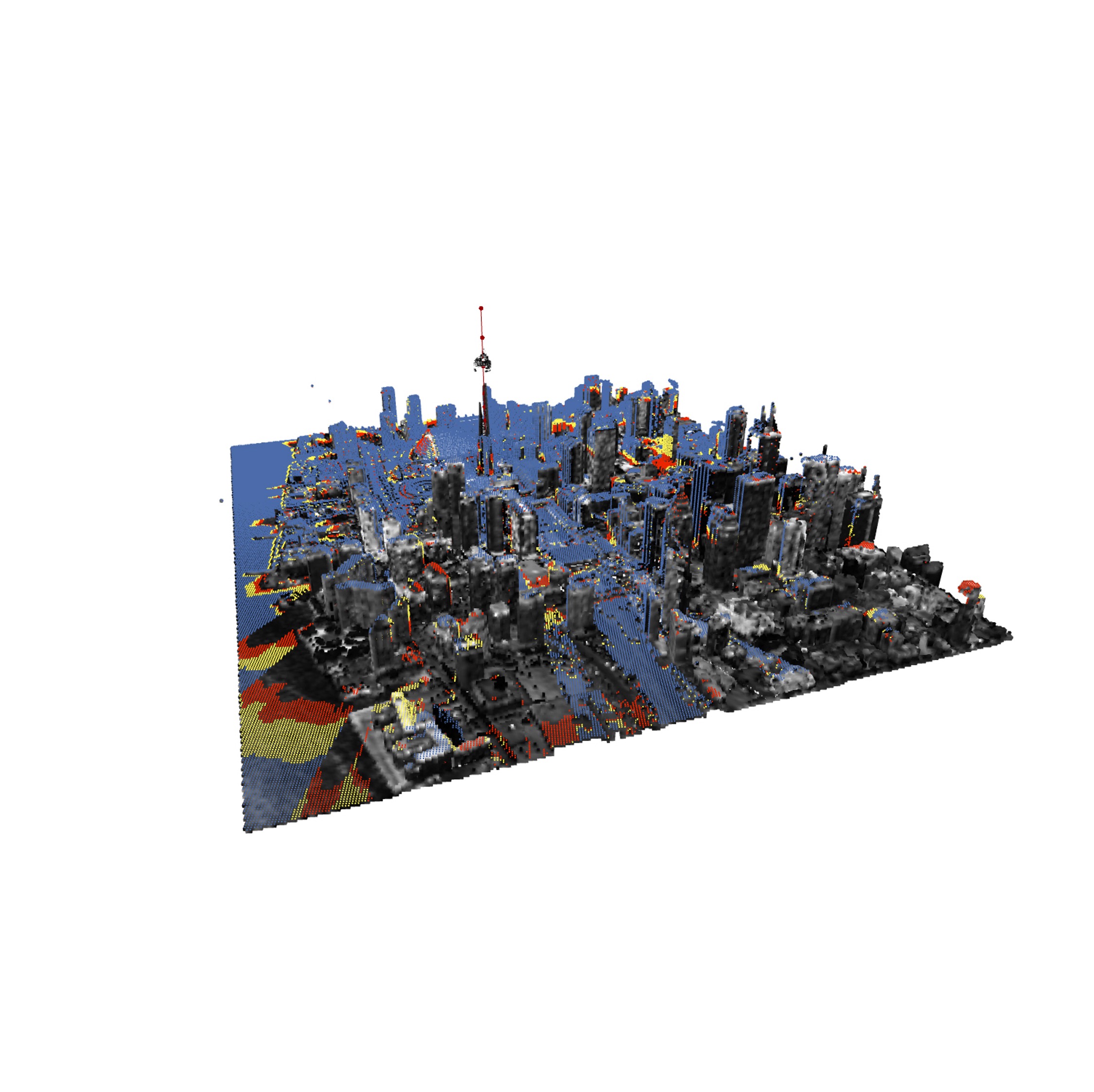
Accurate 3D models support diverse spatial studies, from sightline mapping to environmental performance, as demonstrated by this analysis of CN Tower visibility.
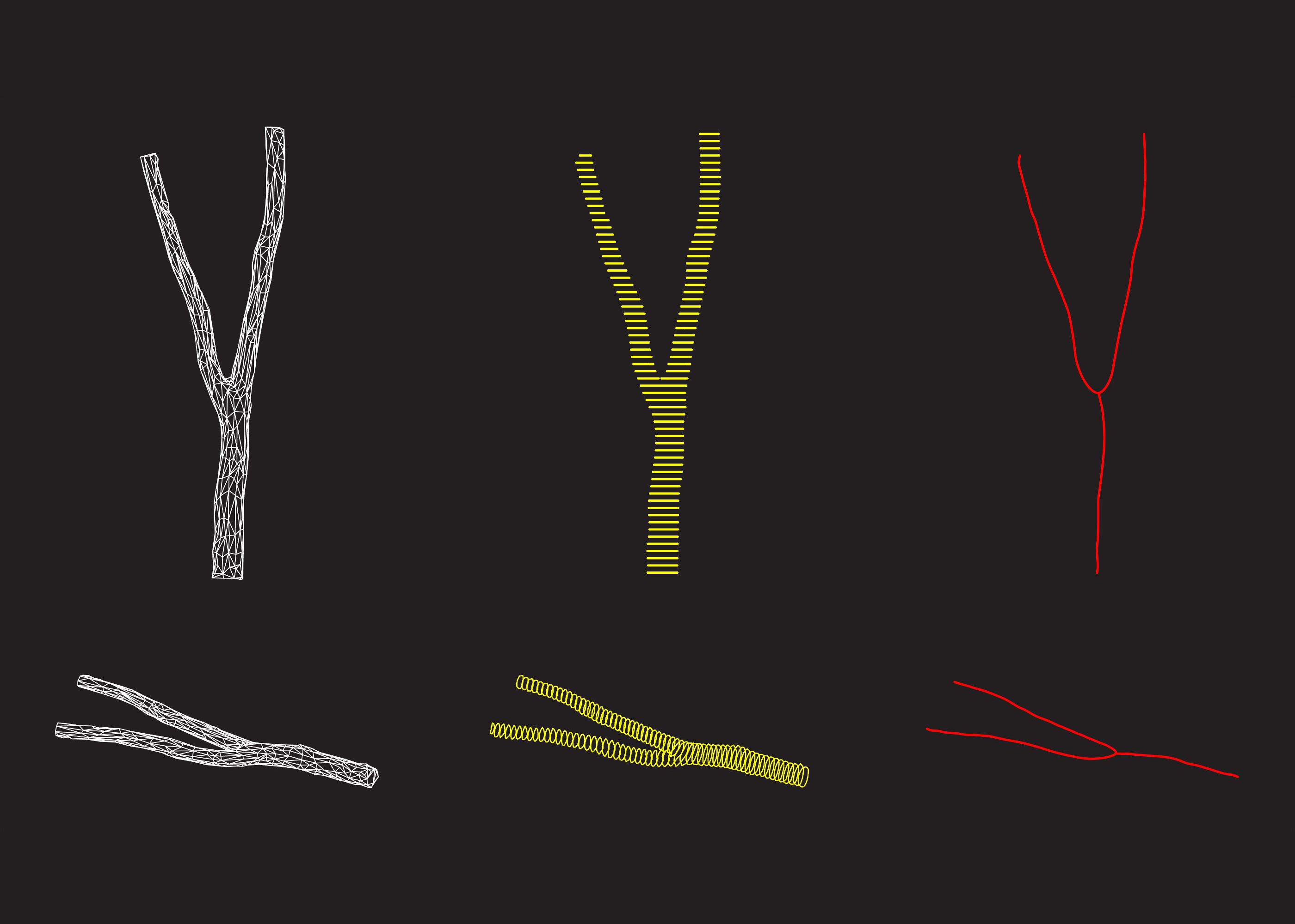
Heavy scan datasets can be distilled into lighter formats—such as centrelines or simplified meshes—making them easier to use in parametric or computational design processes. Case Study
Point clouds affected by lighting artefacts or discoloration can be carefully corrected and regraded, producing clean, consistent visuals for analysis or presentation.
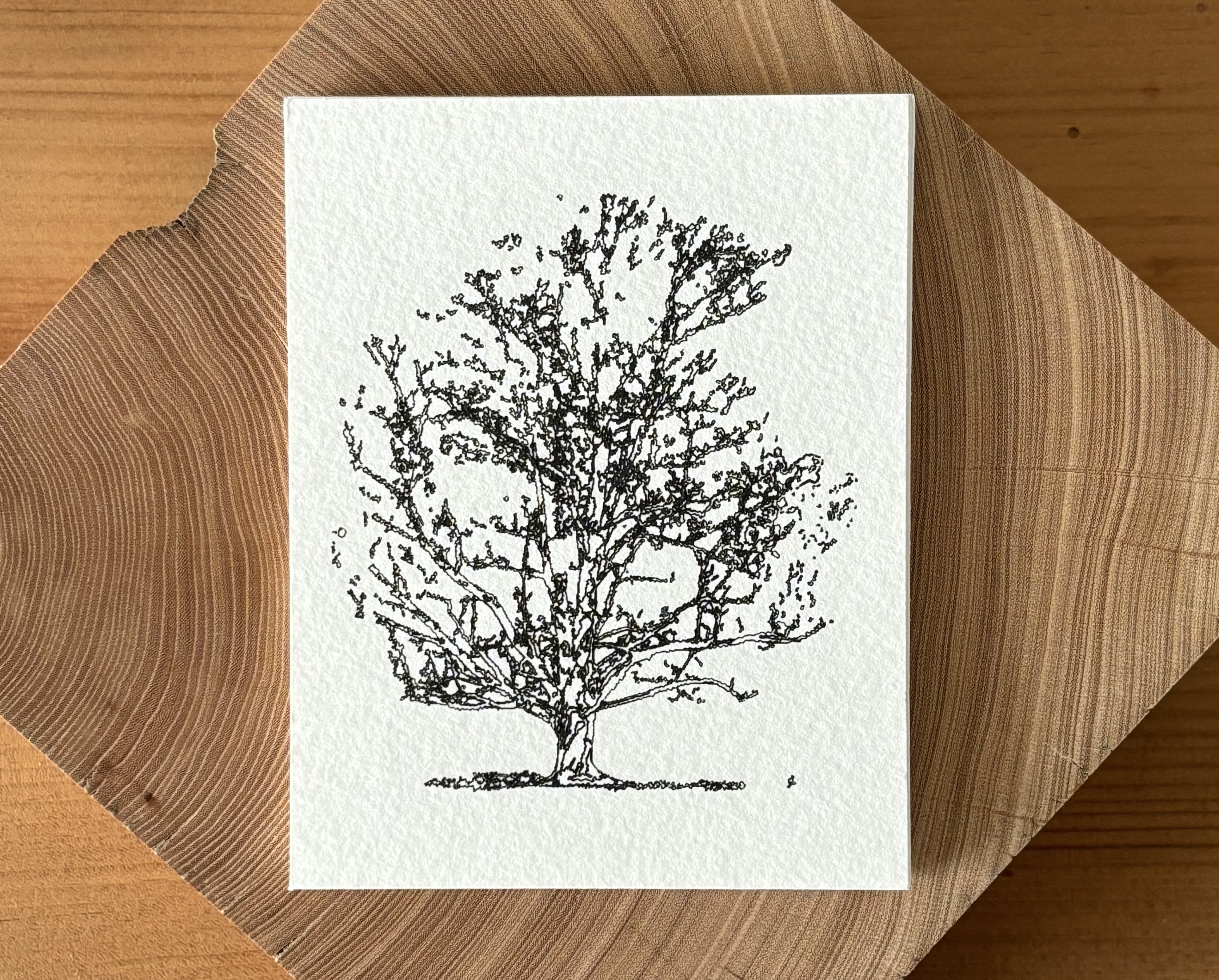
Custom artwork can be generated from scan data, output as conventional prints or produced with CNC pen plotters for distinctive, tactile results.
Point clouds’ semi-transparent qualities enable plans, sections, and elevations that convey more layered spatial information than conventional line drawings.
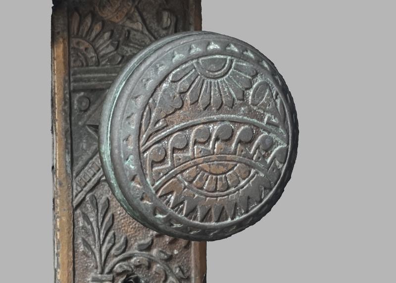
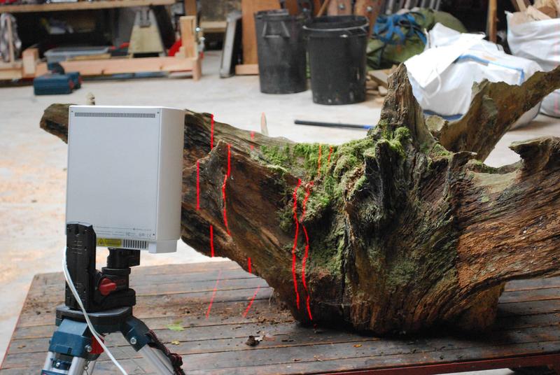
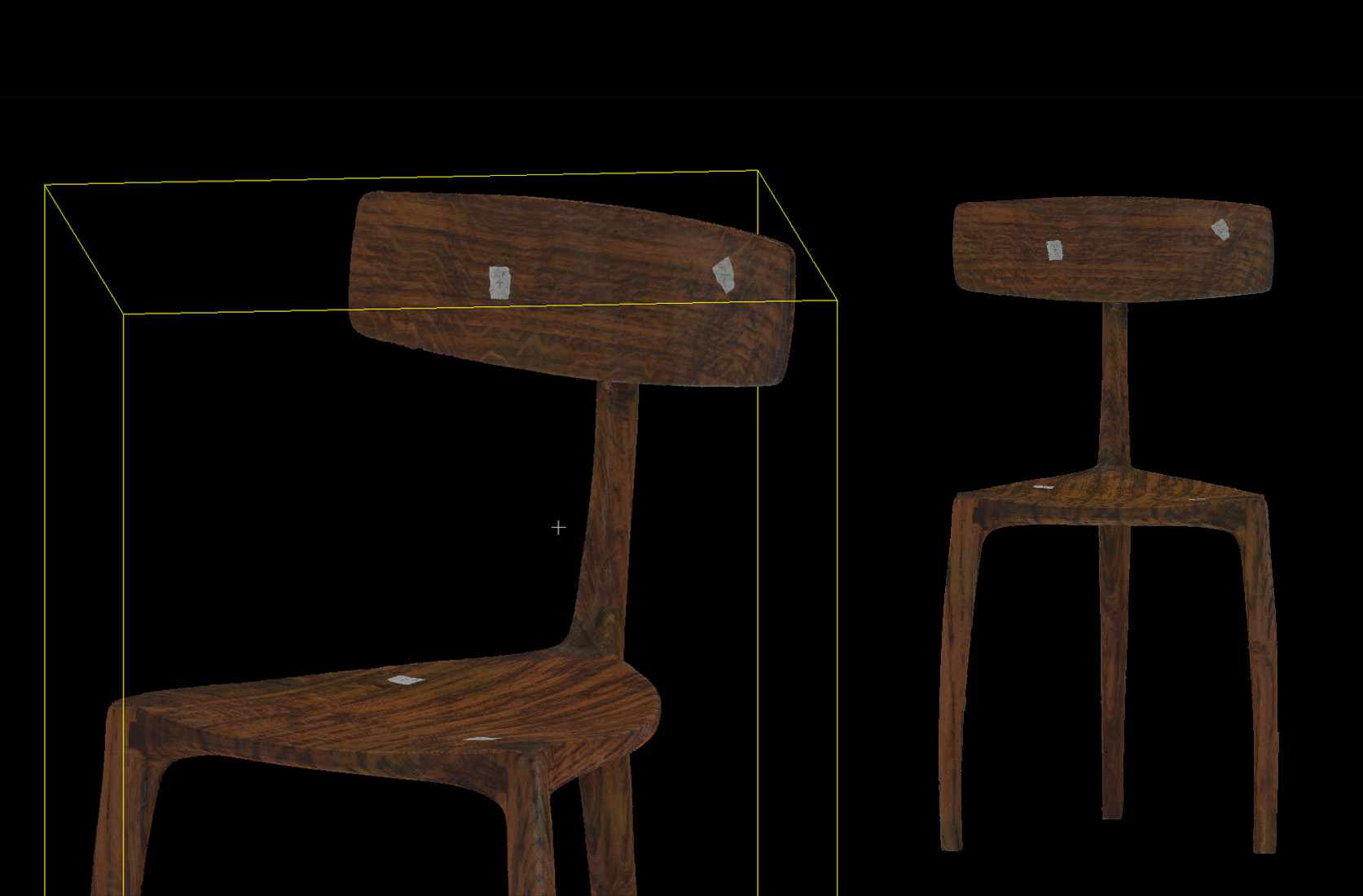
Scanning handmade items allows detailed evaluation of their form, capturing subtle variations and enabling digital refinement or replication.